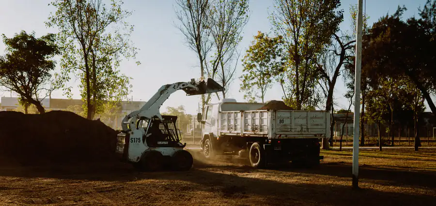
Land Clearing in Aubrey, TX
Fence line, paddock and pasture clearing on the sandy horse country around US 377 and FM 428, next to the Ray Roberts Greenbelt. Send the details and our featured local contractor follows up with a written quote.
Land Clearing in Aubrey, TX and Denton County
Aubrey is in northeastern Denton County, about twelve miles northeast of Denton, with US 377 running north and south through town and FM 428 heading east toward Celina and west toward Denton. The Texas State Historical Association places it in the Cross Timbers region and describes farm country that switched from cotton to peanuts, with an annual average of 3,000 tons processed at the local drying plant by the 1980s, plus cattle, hay, fruit and vegetables. The same source says the sandy, fertile land and moderate climate drew so many horse ranchers that some call the area the horse capital of Texas.
Aubrey is growing quickly from a small base. The U.S. Census Bureau estimated 9,066 residents in July 2025, up from 4,914 in its April 2020 base, close to double in five years. Most clearing work around town still happens on acreage: horse places, small ranches and family tracts being split into homesites.
Two local features shape that work. The ground is sandier than the Collin County blackland to the east, and Ray Roberts Dam, finished nearby on the Elm Fork of the Trinity River in 1986, has a public Greenbelt corridor running south from it toward US 380.
Clearing Services in Aubrey TX
Clearing brush and cedar along property lines and fence lines, plus pasture encroachment and paddock clearing on equestrian properties in Aubrey and Denton County.
Opening and leveling ground for paddocks, round pens and arena pads on horse property.
Taking pasture back from cedar and brush so it can be grazed, mowed or cut for hay.
Clearing a pad, drive and septic area on a tract being split for a new house.
Grinding brush in place and leaving the mulch as ground cover on sandy soil.
Clearing and rough-shaping a drive from the road to the building site.
We handle the clearing and road prep; for gravel delivery on driveway and access projects, Aubrey Gravel supplies and hauls crushed stone across Denton County.
Clearing Property and Fence Lines on Aubrey Acreage
Boundary clearing is one of the most common jobs on Aubrey horse and cattle places. Cedar and brush grow up along fences, hide the line, and make repairs hard. Good boundary work starts with knowing where the line actually is: pull the survey, find the pins, and agree with the neighbor before brush comes out of a shared fence. A clean working strip on your side lets a fence crew reset posts and wire, and lets you see the line again. On horse property, ask that wire, T-posts and old barbed wire buried in brush be pulled and hauled rather than mulched, since loose wire in a pasture is a hazard to stock.
Next to the Ray Roberts Greenbelt
The Greenbelt Corridor below Ray Roberts Dam is federal land managed for public recreation as a controlled access area. Under the Corps of Engineers guidelines for neighbors, adjacent owners may not build gates, walk-throughs or other access through the boundary fence, and mowing and other vegetation removal are not allowed inside the corridor. On some tracts next to the Greenbelt, the Corps also bought conservation easements to keep the land in its scenic, natural condition. Generally, no use of that easement land is allowed beyond continuing existing grazing or crop production, so clearing it for a homesite is off the table. If your Aubrey property backs up to the Greenbelt, read your deed for an easement before planning any clearing near the back fence.
Permits: City of Aubrey and Denton County
Inside city limits, the City of Aubrey publishes a Grading Permit Application and a Driveway, Curb Cut and Culvert Permit on its building permits page. Aubrey's zoning ordinance also lets the Planning and Zoning Commission require a tree survey, prepared by an arborist, licensed surveyor, licensed landscape architect or other approved person, and a tree preservation plan as part of site plan review. On unincorporated land, Denton County's Development Services department treats any improvement to a property as needing a development permit, and digging, filling or culvert work in a flood zone is specifically on its permit list.
Aubrey Soils, Named for the Town
The Aubrey soil series is named for this town; its type location is about three miles east of Aubrey, and the USDA describes it as a sandy-to-loamy surface over a clayey subsoil. Around town, soil survey maps show Gasil fine sandy loam, the Birome-Rayex-Aubrey complex, Callisburg fine sandy loam and Silstid loamy fine sand, with Bunyan fine sandy loam on flood-prone bottoms. Sandy surfaces let equipment back on the ground sooner after rain than the black clay near Celina, but they wash more easily once bare. Leaving mulch or grass on anything that does not need to be bare is the simple fix.
We serve Aubrey as part of our Denton County coverage alongside Pilot Point. For Collin County properties, our coverage includes Celina, Prosper, and the surrounding area.
Tell us the acreage, the fence lines involved, and anything that has to stay. Our featured local contractor uses that to put together their own written quote.
Call Now- Texas State Historical Association: Aubrey, TX
- U.S. Army Corps of Engineers: Ray Roberts Lake guidelines for adjacent property owners (PDF)
- City of Pilot Point: About (Greenbelt trail from FM 455 to US 380)
- City of Aubrey: Building Permits
- City of Aubrey Code: Zoning Ordinance
- Denton County: Applying for Development Permits
- USDA Official Soil Series Description: Aubrey
- U.S. Census Bureau: Vintage 2025 city population estimates, Texas (CSV)
- USDA NRCS Web Soil Survey
Ready to Clear Your Aubrey TX Property?
Free to request. No commitment until you approve a quote.